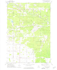
1973 Map of Pleasant Valley
USGS Topo · Published 1976About this map
The Mount Pleasant Oil Field and Porter Oil Field define the industrial character of this landscape along the Isabella and Midland county line. The presence of numerous oil wells and a complex network of pipelines crossing the Tittabawassee River State Forest reveals a territory deeply tied to mid-century resource extraction. Central to this activity is the small settlement of Oil City, situated near the confluence of the Chippewa River and several smaller tributaries like Onion Creek and Black Creek.
Find a feature on this map
50 named features on this map. Tap any name to fly to it.
Don’t see what you’re looking for? This feature index may not catch every label — zoom into the map to look around manually.
Map Details
Editions of this 1973 Pleasant Valley Map
This is the sole edition of this map. No revisions or reprints were ever made.
Other maps of this area

1930 · Shepherd
USGS Topo · 1:48,000

1934 · Sanford
USGS Topo · 1:62,500

1934 · Merrill
USGS Topo · 1:62,500

1935 · Alma
USGS Topo · 1:62,500

1936 · Shepherd
USGS Topo · 1:62,500

1936 · Sanford
USGS Topo · 1:62,500

1937 · Merrill
USGS Topo · 1:62,500

1938 · Alma
USGS Topo · 1:62,500

1954 · Midland
USGS Topo · 1:250,000

1958 · Midland
USGS Topo · 1:250,000