
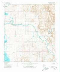
1955 Map of Point Hope B-2
USGS Topo · Published 1966About this map
The Kukpuk River snakes across this Arctic landscape, serving as a primary corridor through the Lisburne Hills during the mid-1950s. Small settlements and camps including Kukpuk, Itublurak, and Kunuk are positioned along its banks or near the coastal drainages, reflecting the traditional movement patterns of the region. The map reveals a land defined by water and high ground, from the expansive Ajautak Lagoon on the edge of the Chukchi Sea to the interior peaks of Mount Niaktuvik and Ogsachak Mountain. Researchers can trace various named tributaries such as Kemegrak Creek and Taktelak Creek as they flow from the high ridges toward the coast. The notation of Kayak (site) provides a specific point of interest for those studying the archaeological or historical habitation of the North Slope.
Find a feature on this map
32 named features on this map. Tap any name to fly to it.
Don’t see what you’re looking for? This feature index may not catch every label — zoom into the map to look around manually.
Map Details
Editions of this 1955 Point Hope B-2 Map
2 editions found
Other maps of this area

1952 · Point Hope
USGS Topo · 1:250,000

1952 · Point Hope A-2
USGS Topo · 1:63,360

1952 · Point Hope B-3
USGS Topo · 1:63,360
1952 · Point Hope C-3
USGS Topo · 1:63,360

1955 · Point Hope
USGS Topo · 1:250,000

1955 · Point Hope C-1
USGS Topo · 1:63,360

1955 · Point Hope A-1
USGS Topo · 1:63,360

1955 · Point Hope B-1
USGS Topo · 1:63,360

1955 · Point Hope C-2
USGS Topo · 1:63,360

1965 · Point Hope
USGS Topo · 1:250,000