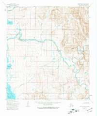
1955 Map of Point Hope B-2
USGS Topo · Published 1981About this map
The Kukpuk River and Ipewik River dominate this coastal Alaskan landscape, where the waters of the Chukchi Sea meet the Ajautak Lagoon. The area is characterized by vast drainage systems and seasonal settlements like Itublarak and Kukpuk positioned along the major waterways. Elevations rise sharply from the riverbanks to prominent landmarks such as Mount Niaktuvik, Ogsachak Mountain, and the Kemegrak Hills. The intricate network of smaller tributaries including Akalolik Creek and Nalakachak Creek reveals a terrain defined by water flow and traditional subsistence routes. This 1955 survey, with later minor revisions, provides a look at the North Slope before significant modern infrastructure, focusing on the natural geography and indigenous place names that define the region's historical identity.
Find a feature on this map
36 named features on this map. Tap any name to fly to it.
Don’t see what you’re looking for? This feature index may not catch every label — zoom into the map to look around manually.
Map Details
Editions of this 1955 Point Hope B-2 Map
2 editions found
Other maps of this area

1952 · Point Hope
USGS Topo · 1:250,000

1952 · Point Hope A-2
USGS Topo · 1:63,360

1952 · Point Hope B-3
USGS Topo · 1:63,360
1952 · Point Hope C-3
USGS Topo · 1:63,360

1955 · Point Hope
USGS Topo · 1:250,000

1955 · Point Hope C-1
USGS Topo · 1:63,360

1955 · Point Hope A-1
USGS Topo · 1:63,360

1955 · Point Hope B-1
USGS Topo · 1:63,360

1955 · Point Hope C-2
USGS Topo · 1:63,360

1955 · Point Hope B-2
USGS Topo · 1:63,360