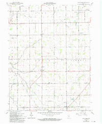
1960 Map of Point Isabel
USGS Topo · Published 1994About this map
Point Isabel sits at the center of this 1960 survey, a small rural crossroads surrounded by the flat agricultural lands of the Green and Liberty townships. The landscape is defined by an extensive network of drainage infrastructure, including family-named features like Wimmer Ditch, Roberts Ditch, and Waters Ditch, which support the intensive farming character of this Indiana region. The map captures the persistence of small community centers like Normal and Rigdon, often anchored by local institutions such as Township Sch and Knox Chapel.
Find a feature on this map
48 named features on this map. Tap any name to fly to it.
Don’t see what you’re looking for? This feature index may not catch every label — zoom into the map to look around manually.
Map Details
Editions of this 1960 Point Isabel Map
4 editions found
Other maps of this area

1953 · Muncie
USGS Topo · 1:250,000

1956 · Muncie
USGS Topo · 1:250,000

1960 · Elwood
USGS Topo · 1:24,000

1960 · Point Isabel
USGS Topo · 1:24,000

1960 · Alexandria
USGS Topo · 1:24,000

1960 · Fairmount
USGS Topo · 1:24,000

1960 · Windfall
USGS Topo · 1:24,000

1960 · Greentown
USGS Topo · 1:24,000

1961 · Marion
USGS Topo · 1:24,000
1962 · Amboy
USGS Topo · 1:24,000