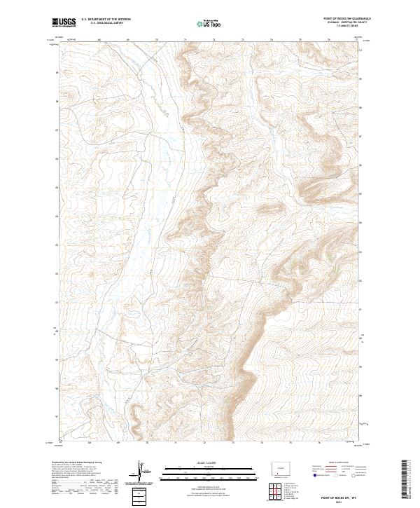
2021 Map of Point of Rocks SW
USGS Topo · Published 2021About this map
Salt Wells Cr flows through this high-elevation Wyoming landscape, carving a primary drainage route through the central and western portions of the quadrangle. The terrain is defined by a dense network of arid draws and ridges, with Black Butte Cr draining the northeastern corner of the map. Human development is sparse, represented primarily by the winding path of Co RD 48, which follows the natural contours of the basin. The map illustrates the geometric overlay of the Public Land Survey System, specifically within the townships of t19n r103w and t18n r102w. This 2021 survey provides a detailed look at the topographic character of the region before further modern infrastructure or energy development might alter the drainage patterns and access roads of this Sweetwater County territory.
Find a feature on this map
7 named features on this map. Tap any name to fly to it.
Don’t see what you’re looking for? This feature index may not catch every label — zoom into the map to look around manually.
Map Details
Editions of this 2021 Point of Rocks SW Map
This is the sole edition of this map. No revisions or reprints were ever made.
Other maps of this area

1908 · Rock Springs
USGS Topo · 1:62,500

1910 · Rock Springs
USGS Topo · 1:62,500

1954 · Rock Springs
USGS Topo · 1:250,000

1958 · Rock Springs
USGS Topo · 1:250,000

1962 · Rock Springs
USGS Topo · 1:250,000

1968 · North Baxter
USGS Topo · 1:24,000

1968 · Cooper Ridge NE
USGS Topo · 1:24,000

1968 · Point Of Rocks SW
USGS Topo · 1:24,000

1968 · Point Of Rocks
USGS Topo · 1:24,000

1968 · Camel Rock
USGS Topo · 1:24,000