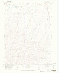
1969 Map of Pole Gulch
USGS Topo · Published 1972About this map
The Little Snake River winds through the northern portion of this Colorado landscape, defining a valley where water management was essential for early ranching and agriculture. The reliance on river water is evidenced by the complex system of irrigation infrastructure, including the Gibson Blair Ditch, Trowel Ditch, and the West Side Canal. These features highlight the effort to divert water from the river and Fourmile Creek to the more arid surrounding terrain.
Find a feature on this map
15 named features on this map. Tap any name to fly to it.
Don’t see what you’re looking for? This feature index may not catch every label — zoom into the map to look around manually.
Map Details
Editions of this 1969 Pole Gulch Map
3 editions found
Other maps of this area

1916 · Craig
USGS Topo · 1:125,000

1954 · Rawlins
USGS Topo · 1:250,000

1954 · Craig
USGS Topo · 1:250,000

1957 · Craig
USGS Topo · 1:250,000

1957 · Baggs
USGS Topo · 1:62,500

1958 · Rawlins
USGS Topo · 1:250,000

1958 · Craig
USGS Topo · 1:250,000

1960 · Craig
USGS Topo · 1:250,000

1962 · Rawlins
USGS Topo · 1:250,000

1962 · Craig
USGS Topo · 1:250,000