
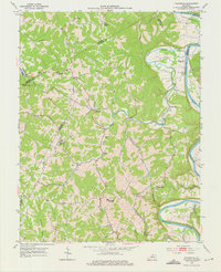
1953 Map of Polsgrove
USGS Topo · Published 1955About this map
Harpers Ferry and Polsgrove define the rural character of this northern Kentucky landscape, where the Kentucky River winds through deeply carved valleys. The 1953 survey shows a region tightly bound by its watercourses, with the river forming natural boundaries between Owen, Henry, and Shelby counties. Settlement patterns are concentrated along high ridges and creek bottoms, anchored by a dense network of country churches like Grub Ridge Ch and Mt Carmel Ch. Educational life centers on the Bald Knob High Sch, while family history is etched into the terrain through numerous small burial grounds, including the Bailey Cem and Waits Cem. The map illustrates the transition from river-dependent crossings to ridge-top communities, with major tributaries like Flat Creek and Sixmile Creek shaping the local geography.
Find a feature on this map
39 named features on this map. Tap any name to fly to it.
Don’t see what you’re looking for? This feature index may not catch every label — zoom into the map to look around manually.
Map Details
Editions of this 1953 Polsgrove Map
4 editions found
Other maps of this area

1906 · Lockport
USGS Topo · 1:48,000

1908 · Lockport
USGS Topo · 1:62,500

1922 · Frankfort
USGS Topo · 1:48,000

1923 · Waddy
USGS Topo · 1:48,000

1924 · Frankfort
USGS Topo · 1:62,500

1925 · Mount Eden
USGS Topo · 1:48,000

1927 · Mount Eden
USGS Topo · 1:62,500

1928 · New Castle
USGS Topo · 1:48,000

1932 · New Castle
USGS Topo · 1:62,500

1953 · Monterey
USGS Topo · 1:24,000