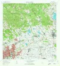
1970 Map of Ponce
USGS Topo · Published 1972About this map
The industrial and agricultural landscape of southern Puerto Rico is dominated by Central Mercedita and the surrounding sugar estate infrastructure near Ponce. The map reveals a transition from the urban density of the city center, with its grid-aligned streets like Calle Isabel and Calle Villa, to a rural periphery defined by numerous family-named haciendas. To the east, the Fort Allen Naval Radio Station and the Estacion Experimental Agricola UPR highlight the region's mid-century strategic and scientific importance.
Find a feature on this map
203 named features on this map. Tap any name to fly to it.
Don’t see what you’re looking for? This feature index may not catch every label — zoom into the map to look around manually.
Map Details
Editions of this 1970 Ponce Map
4 editions found
Other maps of this area

1944 · Santa Isabel
USGS Topo · 1:30,000

1945 · Playa De Ponce
USGS Topo · 1:30,000

1945 · Ponce
USGS Topo · 1:30,000

1945 · Rio Descalabrado
USGS Topo · 1:30,000

1946 · Punta Cuchara
USGS Topo · 1:30,000

1946 · Jayuya
USGS Topo · 1:30,000

1946 · Orocovis
USGS Topo · 1:30,000

1946 · Penuelas
USGS Topo · 1:30,000

1946 · Adjuntas
USGS Topo · 1:30,000

1947 · Ponce NE
USGS Topo · 1:10,000