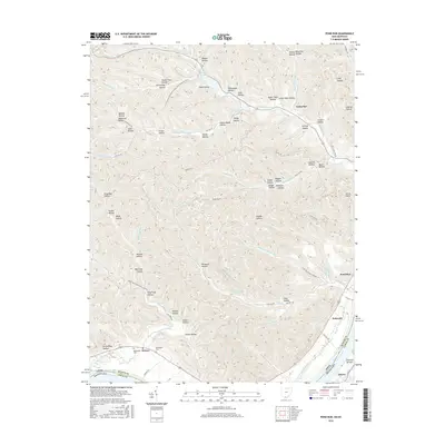
2016 Map of Pond Run
USGS Topo · Published 2016About this map
McDermott Cem and McKendree Cem are situated on the northern banks of the Ohio River, marking the historical presence of family settlements in this riverside landscape. The terrain north of the river is defined by a dense network of hollows, including Hog Thief Hollow and Dead Man Hollow, which descend from the high ridges toward small tributaries like Pond Run and Turkey Creek. This 2016 survey illustrates the modern intersections of conservation and community, showing the North Country National Scenic Trail (Buckeye Trail) winding through the same hills that contain small hamlets like McGaw and Kennvale. Recreation is centered around inland waters such as Roosevelt Lake and Turkey Cr Lake, while the township road network follows the ancient topography of the drainage basins.
Find a feature on this map
99 named features on this map. Tap any name to fly to it.
Don’t see what you’re looking for? This feature index may not catch every label — zoom into the map to look around manually.
Map Details
Editions of this 2016 Pond Run Map
This is the sole edition of this map. No revisions or reprints were ever made.
Other maps of this area

1915 · Garrison
USGS Topo · 1:62,500

1915 · Otway
USGS Topo · 1:62,500

1916 · Peebles
USGS Topo · 1:62,500

1917 · Otway
USGS Topo · 1:62,500

1918 · Garrison
USGS Topo · 1:62,500

1918 · Peebles
USGS Topo · 1:62,500

1919 · Vanceburg
USGS Topo · 1:62,500

1949 · Pond Run
USGS Topo · 1:24,000

1949 · Vanceburg
USGS Topo · 1:62,500

1949 · Garrison
USGS Topo · 1:24,000