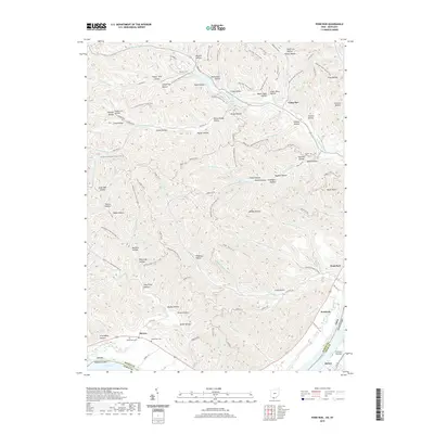
2019 Map of Pond Run
USGS Topo · Published 2019About this map
McDermott Cem and McKendree Cem are situated on the northern bank of the Ohio River, marking the historical burial sites near the settlement of McGaw. This portion of southern Ohio is defined by a dense network of drainages and named hollows, including the evocative Dead Man Hollow and Hog Thief Hollow. The landscape is heavily crisscrossed by recreational infrastructure, from the N Country National Scenic Trail to various bridal and day-hike loops, such as the Day Hike Trail E Loop and Backpack Main Trail N Loop. Small bodies of water like Pond Lick Lake and McBride Lake are tucked between the ridges. Across the river in Kentucky, the community of Quincy and the agricultural lands of Formans Bottom are visible, connected to the Ohio side by the river-valley corridor that has historically shaped the local economy and movement.
Find a feature on this map
118 named features on this map. Tap any name to fly to it.
Don’t see what you’re looking for? This feature index may not catch every label — zoom into the map to look around manually.
Map Details
Editions of this 2019 Pond Run Map
This is the sole edition of this map. No revisions or reprints were ever made.
Other maps of this area

1915 · Garrison
USGS Topo · 1:62,500

1915 · Otway
USGS Topo · 1:62,500

1916 · Peebles
USGS Topo · 1:62,500

1917 · Otway
USGS Topo · 1:62,500

1918 · Garrison
USGS Topo · 1:62,500

1918 · Peebles
USGS Topo · 1:62,500

1919 · Vanceburg
USGS Topo · 1:62,500

1949 · Pond Run
USGS Topo · 1:24,000

1949 · Vanceburg
USGS Topo · 1:62,500

1949 · Garrison
USGS Topo · 1:24,000