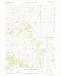
1966 Map of Ponderosa Park
USGS Topo · Published 1979About this map
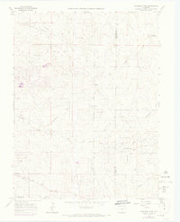
Ponderosa Park and the outskirts of Franktown define this Colorado landscape during the mid-1960s, a period of transition between traditional ranching and rural residential development. The terrain is marked by a complex network of seasonal drainages with evocative names such as Moonshine Gulch, Whiskey Gulch, and Bayou Gulch, which cut through the high plains topography toward Kinney Creek. Evidence of earlier infrastructure remains visible in the form of the Old Railroad Grade winding through the eastern portion of the map, while newer suburban footprints begin to emerge along Panorama Drive and Mustang Road. Local landmarks like Hilltop and Box Spring provide topographical anchors for researchers, and the Barney Bird Reservoir No 1 appears as a critical water resource in this arid environment along the Douglas and Elbert County line.
Find a feature on this map
25 named features on this map. Tap any name to fly to it.
Don’t see what you’re looking for? This feature index may not catch every label — zoom into the map to look around manually.
Map Details
Editions of this 1966 Ponderosa Park Map
7 editions found
Other maps of this area

1890 · East Denver
USGS Topo · 1:125,000

1894 · Castle Rock
USGS Topo · 1:125,000

1913 · Castle Rock
USGS Topo · 1:125,000

1935 · East Denver Nos. 3 and 4
USGS Topo · 1:48,000

1939 · Elizabeth
USGS Topo · 1:62,500

1940 · Piney Creek
USGS Topo · 1:24,000

1940 · Castle Rock
USGS Topo · 1:62,500

1942 · Parker
USGS Topo · 1:31,680

1942 · Piney Creek
USGS Topo · 1:31,680

1945 · Castle Rock
USGS Topo · 1:62,500