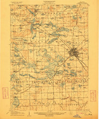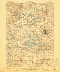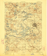
1907 Map of Pontiac
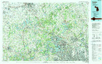
USGS Topo · Published 1937About this map
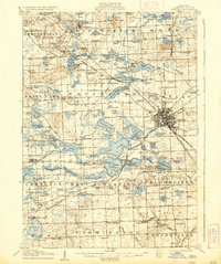
The sprawling lakelands of Oakland County dominate this landscape, showing the transition from early rural townships to the growing industrial center at Pontiac. The map captures a dense network of water bodies, from the large Cass Lake and Orchard Lake to the complex systems of Williams Lake and Watkins Lake. Transportation is in a state of flux, with the Orchard Lake Turnpike and the Detroit and Pontiac Electric R R connecting the emerging suburban settlements. Institutions of the era are prominently marked, including the Asylum on the outskirts of Pontiac and a Military Academy situated on the shore of Orchard Lake.
Find a feature on this map
175 named features on this map. Tap any name to fly to it.
Don’t see what you’re looking for? This feature index may not catch every label — zoom into the map to look around manually.
Map Details
Editions of this 1907 Pontiac Map
5 editions found