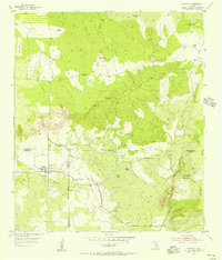
1955 Map of Pontotoc
USGS Topo · Published 1956About this map
Pontotoc sits at the junction of Mason, San Saba, and Llano counties, serving as a focal point for the surrounding cattle country in the mid-1950s. The settlement's history is written into the landscape through the presence of both the Old Pontotoc Cem and the New Pontotoc Cem, suggesting the community's longevity. To the east, the landscape transitions into the hills of Lone Oak Mountain and the rocky outcrops of High Rock and Panther Rock. The map reveals a rural economy based on large landholdings like the Taylor Ranch and 9-Bar Ranch, while signs of shifting social patterns appear at the Hutchinson Sch (Aband). Water sources such as West Deep Creek and Field Creek drain the terrain, providing essential resources for the dispersed ranching homesteads that characterize this portion of the Texas Hill Country.
Find a feature on this map
21 named features on this map. Tap any name to fly to it.
Don’t see what you’re looking for? This feature index may not catch every label — zoom into the map to look around manually.
Map Details
Editions of this 1955 Pontotoc Map
2 editions found
Other maps of this area

1885 · San Saba
USGS Topo · 1:125,000

1887 · Llano
USGS Topo · 1:125,000

1887 · Mason
USGS Topo · 1:125,000

1894 · Brady
USGS Topo · 1:125,000

1894 · Mason
USGS Topo · 1:125,000

1894 · San Saba
USGS Topo · 1:125,000

1894 · Llano
USGS Topo · 1:125,000

1904 · Llano
USGS Topo · 1:125,000

1909 · Llano
USGS Topo · 1:125,000

1918 · Llano
USGS Topo · 1:125,000