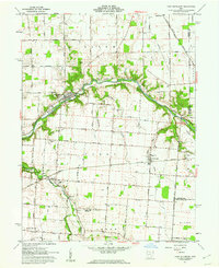
1961 Map of Port Jefferson
USGS Topo · Published 1962About this map
Port Jefferson and the surrounding agricultural townships of Perry and Salem are defined by the winding course of the Miami River in the early 1960s. This survey illustrates the area's transition from 19th-century infrastructure to modern utility corridors, showing the remnants of the Miami Canal alongside newer additions like the Toledo Pipeline and Ironton. The landscape is dotted with ancestral landmarks, including the Old Dunkard Cem and the Pioneer Cem near the river bend.
Find a feature on this map
74 named features on this map. Tap any name to fly to it.
Don’t see what you’re looking for? This feature index may not catch every label — zoom into the map to look around manually.
Map Details
Editions of this 1961 Port Jefferson Map
3 editions found

Other maps of this area

1913 · Bellefontaine
USGS Topo · 1:48,000

1913 · Sidney
USGS Topo · 1:62,500

1914 · Troy
USGS Topo · 1:62,500

1914 · St. Paris
USGS Topo · 1:62,500

1915 · Bellefontaine
USGS Topo · 1:62,500

1916 · St. Paris
USGS Topo · 1:62,500

1944 · Sidney
USGS Topo · 1:62,500

1944 · St. Paris
USGS Topo · 1:62,500

1944 · Troy
USGS Topo · 1:62,500

1944 · Bellefontaine
USGS Topo · 1:62,500