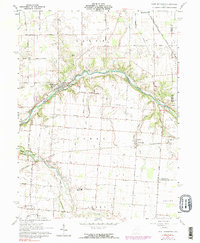
1961 Map of Port Jefferson
USGS Topo · Published 1990About this map
The Great Miami River carves a winding path through this corner of Shelby County, anchoring a landscape defined by small-town life and rural cemeteries. The village of Port Jefferson sits at the river's bend, where local history is recorded in nearby sites like Pioneer Ch and Glen Cem. To the southeast, the settlement of Pemberton is situated along the Penn Central rail line, which cuts across the terrain of Perry and Orange townships. This 1961 field-checked survey reveals the deep-rooted community network of the era, from the Fairlawn High Sch to numerous family and community burial grounds such as Old Dunkard Cem and Medaris Cem. Tributaries like Turkeyfoot Creek and Mosquito Creek drain the surrounding farmlands, while smaller pockets of industry are visible at scattered Gravel Pits.
Find a feature on this map
43 named features on this map. Tap any name to fly to it.
Don’t see what you’re looking for? This feature index may not catch every label — zoom into the map to look around manually.
Map Details
Editions of this 1961 Port Jefferson Map
3 editions found

Other maps of this area

1913 · Bellefontaine
USGS Topo · 1:48,000

1913 · Sidney
USGS Topo · 1:62,500

1914 · Troy
USGS Topo · 1:62,500

1914 · St. Paris
USGS Topo · 1:62,500

1915 · Bellefontaine
USGS Topo · 1:62,500

1916 · St. Paris
USGS Topo · 1:62,500

1944 · Sidney
USGS Topo · 1:62,500

1944 · St. Paris
USGS Topo · 1:62,500

1944 · Troy
USGS Topo · 1:62,500

1944 · Bellefontaine
USGS Topo · 1:62,500