
1952 Map of Port Mansfield
USGS Topo · Published 1953About this map
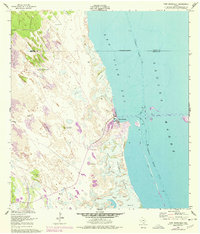
Port Mansfield stands as a vital coastal outpost in Willacy County, appearing here in the early 1950s as a developing maritime hub defined by the Intracoastal Waterway. This area of the Texas coast is characterized by a stark contrast between the marine environments of Red Fish Bay and Laguna Madre and the shifting terrestrial landscape to the west. A network of family-named wells and windmills, such as the Dave Dear Well and Palmital Well North Windmill South Windmill, highlights the critical importance of water management in a region dominated by Shifting Sand Dunes. The presence of a Landing Field near the port indicates the area's increasing accessibility. To the south, Fourmile Slough and El Sauz Island illustrate the intricate shoreline of the Sand and Mud flats that once defined the local economy and geography before later coastal developments.
Find a feature on this map
25 named features on this map. Tap any name to fly to it.
Don’t see what you’re looking for? This feature index may not catch every label — zoom into the map to look around manually.
Map Details
Editions of this 1952 Port Mansfield Map
2 editions found
Other maps of this area

1921 · Tarida Ranch
USGS Topo · 1:62,500

1951 · South of Potrero Lopeno NE
USGS Topo · 1:24,000

1952 · Green Island
USGS Topo · 1:24,000

1952 · South of Potrero Lopeno NW
USGS Topo · 1:24,000

1952 · South of Potrero Lopeno SE
USGS Topo · 1:24,000

1952 · Hawk Island
USGS Topo · 1:24,000

1952 · South of Potrero Lopeno
USGS Topo · 1:62,500

1953 · Brownsville
USGS Topo · 1:250,000
1955 · La Leona
USGS Topo · 1:62,500
1956 · Rosita Lake NE
USGS Topo · 1:24,000