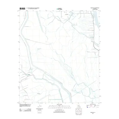
2012 Map of Portage
USGS Topo · Published 2012About this map
Portage and its surrounding wetlands occupy a landscape defined by an intricate network of waterways and levee systems in the early 21st century. The drainage patterns here reveal a complex hydraulic history, with the Atchafalaya River on the eastern edge and the winding Bayou Courtableau feeding into a web of smaller tributaries like Little Fordoche Bayou and Bayou Fordoche. The presence of the Krotz Springs Oil and Gas Field and North Cecilia Gas Field indicates the region's reliance on mineral extraction alongside its traditional aquatic geography. Many local roads carry family names, such as Joe Schexnailder Rd and Lynn Hardy Rd, providing valuable clues for genealogists tracking local land ownership. Significant infrastructure, including the Grand Canal and Portage Levee Rd, highlights the ongoing human effort to manage the water of the Bayou Fusilier of the Swamps.
Find a feature on this map
58 named features on this map. Tap any name to fly to it.
Don’t see what you’re looking for? This feature index may not catch every label — zoom into the map to look around manually.
Map Details
Editions of this 2012 Portage Map
This is the sole edition of this map. No revisions or reprints were ever made.
Other maps of this area

1935 · Osca Bayou
USGS Topo · 1:62,500

1939 · Fordoche
USGS Topo · 1:62,500

1940 · Arnaudville
USGS Topo · 1:62,500

1954 · Baton Rouge
USGS Topo · 1:250,000

1955 · Osca Bayou
USGS Topo · 1:62,500

1955 · Fordoche
USGS Topo · 1:62,500

1956 · Baton Rouge
USGS Topo · 1:250,000
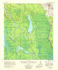
1959 · Osca Bayou
USGS Topo · 1:62,500

1959 · Fordoche
USGS Topo · 1:62,500

1959 · Palmetto
USGS Topo · 1:62,500