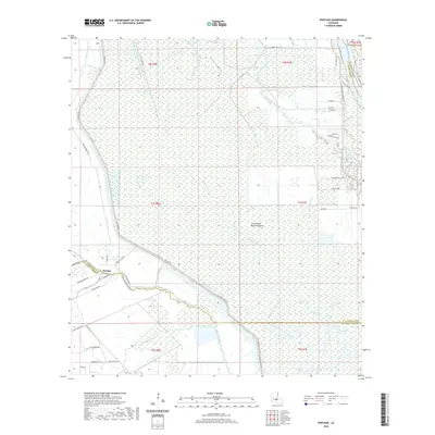
2020 Map of Portage
USGS Topo · Published 2020About this map
Portage sits at the western edge of a complex hydraulic landscape defined by the Atchafalaya Basin Floodway. The terrain is a network of managed water and natural drainage, where the Atchafalaya River and the Bayou Courtableau Outlet Channel dominate the hydrology. The mapping reveals the essential role of levees and spillways in this region, with Portage Levee Rd and Spillway Rd tracing the lines of flood control that protect the settled areas from the expansive wetlands to the east.
Find a feature on this map
57 named features on this map. Tap any name to fly to it.
Don’t see what you’re looking for? This feature index may not catch every label — zoom into the map to look around manually.
Map Details
Editions of this 2020 Portage Map
This is the sole edition of this map. No revisions or reprints were ever made.
Other maps of this area

1935 · Osca Bayou
USGS Topo · 1:62,500

1939 · Fordoche
USGS Topo · 1:62,500

1940 · Arnaudville
USGS Topo · 1:62,500

1954 · Baton Rouge
USGS Topo · 1:250,000

1955 · Osca Bayou
USGS Topo · 1:62,500

1955 · Fordoche
USGS Topo · 1:62,500

1956 · Baton Rouge
USGS Topo · 1:250,000
1959 · Osca Bayou
USGS Topo · 1:62,500

1959 · Fordoche
USGS Topo · 1:62,500

1959 · Palmetto
USGS Topo · 1:62,500