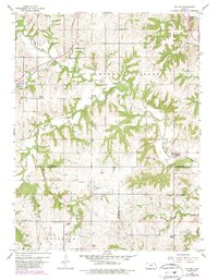
1960 Map of Potter
USGS Topo · Published 1986About this map
Stranger Creek and its many tributaries, including Crooked Creek and Mooney Creek, carve through the rolling terrain where Atchison, Jefferson, and Leavenworth counties meet. This landscape is marked by a legacy of rural education and faith, evidenced by several numbered schoolhouses like School No 74 and School No 17, alongside the Corpus Christi Sch and Corpus Christi Cem complex. The settlements of Potter and Hawthorne are tied together by the remnants of transit history, specifically the Atchison Topeka and Santa Fe Railroad Grade and sections of an Old Railroad Grade. These transport corridors once dictated the growth of small communities like Cummings, while numerous family and community burial grounds, such as Round Mound Cem and Evergreen Cem, provide fixed points for genealogical research in these three-county borderlands.
Find a feature on this map
32 named features on this map. Tap any name to fly to it.
Don’t see what you’re looking for? This feature index may not catch every label — zoom into the map to look around manually.
Map Details
Editions of this 1960 Potter Map
4 editions found
Other maps of this area

1885 · Atchison
USGS Topo · 1:125,000

1886 · Oskaloosa
USGS Topo · 1:125,000

1888 · Oskaloosa
USGS Topo · 1:125,000

1888 · Atchison
USGS Topo · 1:125,000

1893 · Atchison
USGS Topo · 1:125,000

1894 · Oskaloosa
USGS Topo · 1:125,000

1926 · Atchison
USGS Topo · 1:62,500

1948 · Oak Mills
USGS Topo · 1:24,000

1950 · Kansas City
USGS Topo · 1:250,000

1950 · Easton
USGS Topo · 1:24,000