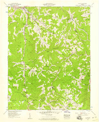
1957 Map of Pound
USGS Topo · Published 1959About this map
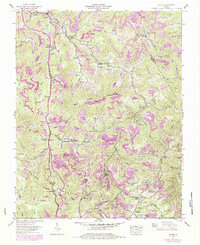
Pound is the primary settlement on this late-1950s map of Wise and Dickenson Counties, situated along the North Fork Pound River and the Chesapeake and Ohio railroad. The landscape is defined by the steep, wooded slopes of Bold Camp Mountain and Indian Mountain, with narrow hollows housing a dense network of family cemeteries and small rural institutions. Numerous strip mines and the Clinchfield-Moss Mines indicate the intense coal industry of the era, which operated alongside established communities centered on places like Skeen Union Church and Harmony Chapel. Large portions of the terrain fall within the Jefferson National Forest, where the Tennessee Valley Divide marks the high ridges above the Cranes Nest River. The distribution of Boggs Sch and Collins Sch suggests a dispersed rural population reliant on the winding roads and mountain gaps such as Bean Gap for travel.
Find a feature on this map
106 named features on this map. Tap any name to fly to it.
Don’t see what you’re looking for? This feature index may not catch every label — zoom into the map to look around manually.
Map Details
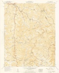
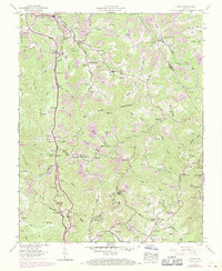
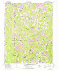
Editions of this 1957 Pound Map
5 editions found
Other maps of this area

1886 · Grundy
USGS Topo · 1:125,000

1890 · Whitesburg
USGS Topo · 1:125,000

1890 · Grundy
USGS Topo · 1:125,000

1892 · Grundy
USGS Topo · 1:125,000

1892 · Whitesburg
USGS Topo · 1:125,000

1894 · Estillville
USGS Topo · 1:125,000

1897 · Bristol
USGS Topo · 1:125,000

1902 · Bristol
USGS Topo · 1:125,000

1912 · Pound
USGS Topo · 1:48,000

1913 · Clintwood
USGS Topo · 1:62,500