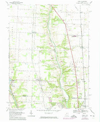
1967 Map of Powell
USGS Topo · Published 1974About this map
The Olentangy River carves a deep central valley through this Delaware County landscape, separating the developing rail settlements of Powell and Lewis Center. During the mid-1960s, the area maintained a mix of suburban growth and established rural landmarks, including the notable Olentangy Caverns and Camp Lazarus. The western edge is defined by the Scioto River and the O'Shaughnessy Reservoir, where the Columbus Zoo sits near the O'Shaughnessy Dam. Transportation networks are a primary focus, with the Norfolk and Western, Penn Central, and Chesapeake and Ohio railroads traversing the townships. Local history is preserved in small burial grounds like Williamsville Cem and Cole Cem, while the burgeoning population is evidenced by Olentangy High Sch and several country clubs.
Find a feature on this map
47 named features on this map. Tap any name to fly to it.
Don’t see what you’re looking for? This feature index may not catch every label — zoom into the map to look around manually.
Map Details
Editions of this 1967 Powell Map
4 editions found
Other maps of this area

1901 · Dublin
USGS Topo · 1:62,500

1902 · Westerville
USGS Topo · 1:62,500

1903 · Dublin
USGS Topo · 1:62,500

1904 · Westerville
USGS Topo · 1:62,500

1915 · Marengo
USGS Topo · 1:62,500

1924 · Delaware
USGS Topo · 1:62,500

1925 · Delaware
USGS Topo · 1:62,500

1943 · Marengo
USGS Topo · 1:62,500

1944 · Delaware
USGS Topo · 1:62,500

1950 · Marion
USGS Topo · 1:250,000