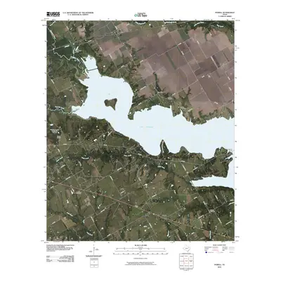
2010 Map of Powell
USGS Topo · Published 2010About this map
Lake Corsicana dominates the central geography of this Navarro County region, serving as a primary reservoir fed by the waters of Chambers Creek and Post Oak Creek. The landscape transition from open water to shoreline is marked by the Lake Corsicana Dam and the Soil Conservation Service Site 141 Dam, highlighting the managed water systems critical to this part of Texas. Settlement patterns follow the higher ground surrounding the reservoir, with established communities like Powell to the north and Eureka to the south.
Find a feature on this map
69 named features on this map. Tap any name to fly to it.
Don’t see what you’re looking for? This feature index may not catch every label — zoom into the map to look around manually.
Map Details
Editions of this 2010 Powell Map
This is the sole edition of this map. No revisions or reprints were ever made.
Other maps of this area

1954 · Dallas
USGS Topo · 1:250,000

1954 · Waco
USGS Topo · 1:250,000

1955 · Waco
USGS Topo · 1:250,000

1958 · Dallas
USGS Topo · 1:250,000

1959 · Powell
USGS Topo · 1:24,000

1960 · Winkler
USGS Topo · 1:24,000

1960 · Streetman
USGS Topo · 1:24,000

1960 · Goodlow Park
USGS Topo · 1:24,000

1961 · Kerens
USGS Topo · 1:24,000

1961 · Chatfield
USGS Topo · 1:24,000