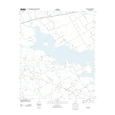
2012 Map of Powell
USGS Topo · Published 2012About this map
Lake Corsicana dominates the central landscape of this 2012 study, its fingers reaching into the surrounding Navarro County countryside. To the north, the small settlement of Powell sits along the rail line, while Elm Flat and Eureka anchor the eastern and southern portions of the quadrangle. The area retains a rural character defined by a dense network of county roads like Se 0080 RD and Se 0120 RD that connect scattered homesteads and local landmarks.
Find a feature on this map
105 named features on this map. Tap any name to fly to it.
Don’t see what you’re looking for? This feature index may not catch every label — zoom into the map to look around manually.
Map Details
Editions of this 2012 Powell Map
This is the sole edition of this map. No revisions or reprints were ever made.
Other maps of this area

1954 · Dallas
USGS Topo · 1:250,000

1954 · Waco
USGS Topo · 1:250,000

1955 · Waco
USGS Topo · 1:250,000

1958 · Dallas
USGS Topo · 1:250,000

1959 · Powell
USGS Topo · 1:24,000

1960 · Winkler
USGS Topo · 1:24,000

1960 · Streetman
USGS Topo · 1:24,000

1960 · Goodlow Park
USGS Topo · 1:24,000

1961 · Kerens
USGS Topo · 1:24,000

1961 · Chatfield
USGS Topo · 1:24,000