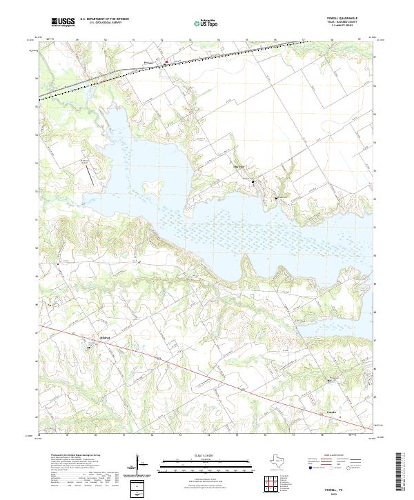
2022 Map of Powell
USGS Topo · Published 2022About this map
Lake Corsicana dominates this Navarro County landscape, its sprawling shoreline reaching deep into the drainage basins of Chambers Creek and Post Oak Creek. The 2022 survey captures the area’s rural character, anchored by the historic communities of Powell, Mildred, and Eureka. For those researching local family history, several burial sites are documented across the terrain, including Elm Flat Cem, Woods Cem, and the Providence Cem near Mildred. The settlement at Elm Flat sits on the higher ground north of the reservoir, while the JTJ Ranch Airport serves as a small aviation landmark in the western sector. The map’s road network, featuring routes like FM 2859 and FM 1393, illustrates the modern connectivity between these farming and lakeside communities, even as old watercourses like Cedar Cr and Crab Cr continue to define the underlying geography of the Texas plains.
Find a feature on this map
107 named features on this map. Tap any name to fly to it.
Don’t see what you’re looking for? This feature index may not catch every label — zoom into the map to look around manually.
Map Details
Editions of this 2022 Powell Map
This is the sole edition of this map. No revisions or reprints were ever made.
Other maps of this area

1954 · Dallas
USGS Topo · 1:250,000

1954 · Waco
USGS Topo · 1:250,000

1955 · Waco
USGS Topo · 1:250,000

1958 · Dallas
USGS Topo · 1:250,000

1959 · Powell
USGS Topo · 1:24,000

1960 · Winkler
USGS Topo · 1:24,000

1960 · Streetman
USGS Topo · 1:24,000

1960 · Goodlow Park
USGS Topo · 1:24,000

1961 · Kerens
USGS Topo · 1:24,000

1961 · Chatfield
USGS Topo · 1:24,000