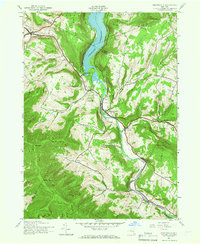
1945 Map of Prattsville
USGS Topo · Published 1966About this map
The Schoharie Reservoir dominates the northern valley of this 1945 survey, marking a landscape defined by the intersection of Schoharie, Delaware, and Greene counties. The village of Prattsville sits at the bend of the Schoharie Creek, flanked by steep elevations like Prospect Hill and the distinctive Pratt Rocks. To the northwest, the settlement of Grand Gorge serves as a gateway near the headwaters of the Bear Kill, while the southern reaches of the map climb into the high peaks of Catskill State Park, including Bearpen Mtn and Roundtop.
Find a feature on this map
47 named features on this map. Tap any name to fly to it.
Don’t see what you’re looking for? This feature index may not catch every label — zoom into the map to look around manually.
Map Details
Editions of this 1945 Prattsville Map
3 editions found
Other maps of this area

1900 · Phoenicia
USGS Topo · 1:62,500

1901 · Margaretville
USGS Topo · 1:62,500

1901 · Gilboa
USGS Topo · 1:62,500

1903 · Gilboa
USGS Topo · 1:62,500

1903 · Phoenicia
USGS Topo · 1:62,500

1904 · Hobart
USGS Topo · 1:62,500

1904 · Margaretville
USGS Topo · 1:62,500

1945 · West Kill
USGS Topo · 1:24,000

1945 · Gilboa
USGS Topo · 1:24,000

1945 · Fleischmanns
USGS Topo · 1:24,000