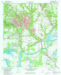
1981 Map of Prattville
USGS Topo · Published 1981About this map
Prattville serves as the focal point of this early 1980s landscape, where industrial activity and educational research meet the winding waters of the Alabama River. The map reveals a dense network of local institutions, including the Auburn University Prattville Experimental Field and the historic Courthouse and City Hall at the town center. The influence of the river is prominent, with the Jones Bluff Lake reservoir and extensive wetlands like Merritt Swamp and Savanna Swamp defining the southern reaches. This era shows the community's infrastructure in detail, from the Illinois Central Gulf Railroad lines to local landmarks like the Drive-in Theater and Gin Shop Hill. Genealogists will find a wealth of burial sites throughout the quadrangle, including Oak Hill Cem, Memory Gardens (Cemetery), and Rodgers Cem, alongside rural congregations such as Lilly Hill Ch.
Find a feature on this map
65 named features on this map. Tap any name to fly to it.
Don’t see what you’re looking for? This feature index may not catch every label — zoom into the map to look around manually.
Map Details
Editions of this 1981 Prattville Map
2 editions found
Other maps of this area

1891 · Clanton
USGS Topo · 1:125,000

1901 · Wetumpka
USGS Topo · 1:125,000

1903 · Wetumpka
USGS Topo · 1:125,000

1927 · Montgomery
USGS Topo · 1:48,000

1930 · Montgomery
USGS Topo · 1:62,500

1953 · Montgomery
USGS Topo · 1:250,000

1956 · Montgomery
USGS Topo · 1:250,000

1957 · Montgomery
USGS Topo · 1:250,000

1957 · Autaugaville
USGS Topo · 1:62,500

1958 · Montgomery
USGS Topo · 1:62,500