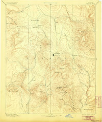
1892 Map of Prescott
USGS Topo · Published 1905About this map
Prescott serves as the focal point of this territorial-era survey, positioned as a critical hub between the Sierra Prieta and the Lonesome Valley. The map documents the region's transition from a military frontier to a mining and ranching economy, with Fort Whipple standing adjacent to the developing townsite. To the south, the Bradshaw Mountains are dotted with high-elevation settlements and mining outposts such as Bueno, Measville, and the remote Tip Top.
Find a feature on this map
67 named features on this map. Tap any name to fly to it.
Don’t see what you’re looking for? This feature index may not catch every label — zoom into the map to look around manually.
Map Details
Editions of this 1892 Prescott Map
5 editions found
Other maps of this area

1886 · Diamond Creek
USGS Topo · 1:250,000

1886 · San Francisco Mtns
USGS Topo · 1:250,000

1886 · Chino
USGS Topo · 1:250,000

1887 · Verde
USGS Topo · 1:250,000

1887 · Prescott
USGS Topo · 1:250,000

1891 · San Francisco Mtns
USGS Topo · 1:250,000

1891 · Chino
USGS Topo · 1:250,000

1892 · Verde
USGS Topo · 1:250,000

1892 · Diamond Creek
USGS Topo · 1:250,000

1892 · Prescott
USGS Topo · 1:250,000