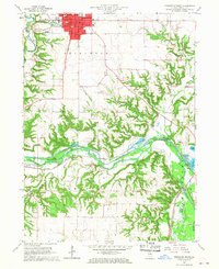
1966 Map of Princeton South
USGS Topo · Published 1968About this map
Princeton serves as the focal point of this mid-1960s landscape, with its residential grid and civic institutions including Perry Hospital and the Courthouse well-defined. The city is surrounded by a dense network of educational facilities like Washington Sch and Logan Sch, while Oakland Cemetery and Greene Cem provide valuable markers for genealogical research. South of the city, the terrain drops into the bottomlands carved by Big Bureau Creek and East Bureau Creek. This area is dominated by the Chicago Rock Island and Pacific railroad corridor, which follows the winding watercourse toward Bureau. The presence of numerous Gravel Pit operations near Lake Arispie and Lake Rawson reflects the industrial activity in the valley during this era, while landmarks like the Piper Airport and Bureau Valley Country Club mark the transition from urban to rural use.
Find a feature on this map
32 named features on this map. Tap any name to fly to it.
Don’t see what you’re looking for? This feature index may not catch every label — zoom into the map to look around manually.
Map Details
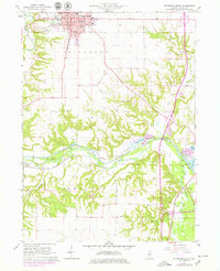
Editions of this 1966 Princeton South Map
2 editions found
Other maps of this area

1893 · Lacon
USGS Topo · 1:62,500

1893 · Hennepin
USGS Topo · 1:62,500

1909 · Hennepin
USGS Topo · 1:62,500

1911 · Hennepin
USGS Topo · 1:62,500

1921 · Buda
USGS Topo · 1:62,500

1923 · Buda
USGS Topo · 1:62,500

1933 · Lacon
USGS Topo · 1:62,500

1933 · Camp Grove
USGS Topo · 1:48,000

1937 · Lacon
USGS Topo · 1:62,500

1945 · Bradford
USGS Topo · 1:62,500