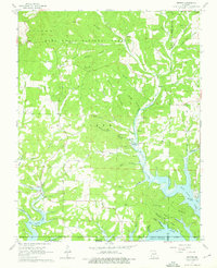
1968 Map of Protem
USGS Topo · Published 1976About this map
Protem and Rueter anchor this mid-1960s Ozark landscape, where the rugged topography of the Mark Twain National Forest meets the rising waters of the White River basin. The map reveals a transition in land use, showing the deep-cut valleys of Big Creek and Shoal Creek before they merge into the expansive Bull Shoals Lake. The social fabric of these rural communities is visible through the placement of landmarks like the Mark Twain Sch, Union Ch, and several family-named burial grounds including Wolf Cem and Merritt Cem. Subterranean features like Tumbling Creek Cave and Cole Cave highlight the region's karst geology. This survey captures the area after the creation of the reservoir but before modern development, preserving the locations of earlier settlements such as Nance and Ocie near the Taney and Ozark county line.
Find a feature on this map
63 named features on this map. Tap any name to fly to it.
Don’t see what you’re looking for? This feature index may not catch every label — zoom into the map to look around manually.
Map Details
Editions of this 1968 Protem Map
2 editions found
Other maps of this area

1893 · Yellville
USGS Topo · 1:125,000

1903 · Yellville
USGS Topo · 1:125,000

1905 · Yellville
USGS Topo · 1:125,000

1929 · Yellville
USGS Topo · 1:125,000

1936 · Thornfield
USGS Topo · 1:48,000

1943 · Protem
USGS Topo · 1:62,500

1943 · Thornfield
USGS Topo · 1:62,500

1945 · Harrison
USGS Topo · 1:250,000

1945 · Thornfield
USGS Topo · 1:62,500

1949 · Harrison
USGS Topo · 1:250,000