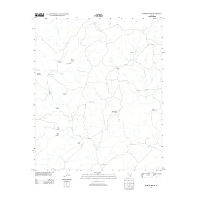
2012 Map of Pursley House
USGS Topo · Published 2012About this map
Croton Cr and its many seasonal tributaries carve a complex drainage system through this portion of King County, defining a landscape of canyons and remote ranching outposts. Family-named landmarks such as Pursley House and Beggs Ranch anchor the local geography, alongside infrastructure like the Beggs Ranch Airport and various cattle-rearing improvements including Getaway Pens. The map reveals a land heavily utilized for ranching, evidenced by the numerous named water sources required for livestock in this arid environment, from the White Face Windmill and Sullivan Windmill to the Sage Tank.
Find a feature on this map
34 named features on this map. Tap any name to fly to it.
Don’t see what you’re looking for? This feature index may not catch every label — zoom into the map to look around manually.
Map Details
Editions of this 2012 Pursley House Map
This is the sole edition of this map. No revisions or reprints were ever made.
Other maps of this area

1954 · Lubbock
USGS Topo · 1:250,000

1958 · Pursley House
USGS Topo · 1:24,000

1958 · Southerland Canyon
USGS Topo · 1:24,000

1958 · Seven Diamond L Canyon
USGS Topo · 1:24,000

1958 · Jayton
USGS Topo · 1:24,000

1959 · Gilpin
USGS Topo · 1:24,000

1959 · Girard
USGS Topo · 1:24,000

1968 · Pitchfork Ranch
USGS Topo · 1:24,000

1968 · Croton Camp
USGS Topo · 1:24,000

1968 · Pitchfork Flats
USGS Topo · 1:24,000