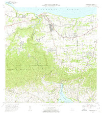
1972 Map of Quebradillas
USGS Topo · Published 1974About this map
Quebradillas sits perched above the northwestern coast of Puerto Rico, overlooking the Atlantic Ocean where the Rio Guajataca carves a deep limestone canyon through the landscape. The northern coastal plains are divided into traditional barrios such as Terranova, San Jose, and Yeguada, while the southern interior rises into the karst hills of the Bosque Estatal de Guajataca.
Find a feature on this map
63 named features on this map. Tap any name to fly to it.
Don’t see what you’re looking for? This feature index may not catch every label — zoom into the map to look around manually.
Map Details
Editions of this 1972 Quebradillas Map
2 editions found
Other maps of this area

1937 · Moca
USGS Topo · 1:20,000

1938 · Alto Sano
USGS Topo · 1:20,000

1938 · Camuy
USGS Topo · 1:20,000

1938 · San Sebastian
USGS Topo · 1:20,000

1938 · Quebradillas
USGS Topo · 1:20,000

1941 · Moca
USGS Topo · 1:30,000

1941 · Isabela
USGS Topo · 1:30,000

1941 · San Sebastian
USGS Topo · 1:30,000

1942 · Moca
USGS Topo · 1:30,000

1942 · Central La Plata
USGS Topo · 1:30,000
Featured Places
- Quebradillas
- Reparto Apolonio Vélez Ramos, Isabela
- Villa Ledumerced, Quebradillas
- Hacienda La Sabana, Camuy
- Brisas de la Sabana, Camuy