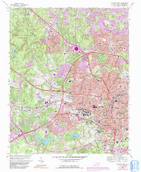
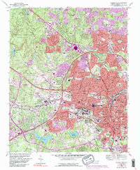
1968 Map of Raleigh West
USGS Topo · Published 1991About this map
North Carolina State University and the downtown core of Raleigh serve as the focal point of this late 1960s study, which also captures the westward expansion toward Cary. The urban landscape is punctuated by institutional landmarks such as Meredith College, the State Fairgrounds, and Dorothea Dix State Hospital. To the north and west, the map details the wooded expanses of William B Umstead State Park and the Carl Alwin Schenck Memorial Forest, providing a look at the capital's fringes before the significant suburban infill of the late 20th century.
Find a feature on this map
138 named features on this map. Tap any name to fly to it.
Don’t see what you’re looking for? This feature index may not catch every label — zoom into the map to look around manually.
Map Details
Editions of this 1968 Raleigh West Map
6 editions found

Other maps of this area

1943 · Durham South
USGS Topo · 1:62,500

1943 · Raleigh
USGS Topo · 1:62,500

1951 · Raleigh
USGS Topo · 1:62,500

1951 · Durham South
USGS Topo · 1:62,500

1953 · Raleigh
USGS Topo · 1:250,000

1954 · Raleigh
USGS Topo · 1:250,000

1964 · Lake Wheeler
USGS Topo · 1:24,000

1964 · Garner
USGS Topo · 1:24,000

1964 · Garner
USGS Topo · 1:62,500
1967 · Wake Forest
USGS Topo · 1:24,000