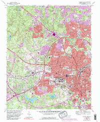
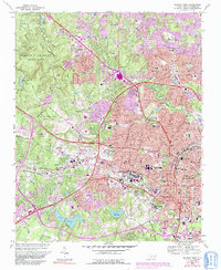
1968 Map of Raleigh West
USGS Topo · Published 1991About this map
The western expansion of Raleigh and the burgeoning campus of North Carolina State University define this landscape during a period of significant suburban development. The map details the transition from the institutional core of the State Capitol and Governor Mansion to the sprawling research and educational tracts of the N.C.S.U. Research Unit and Meredith College. Beyond the academic and government centers, the map documents established local communities like Method and Caraleigh, alongside large-scale public facilities including the Dorothea Dix State Hospital and Central Prison.
Find a feature on this map
110 named features on this map. Tap any name to fly to it.
Don’t see what you’re looking for? This feature index may not catch every label — zoom into the map to look around manually.
Map Details
Editions of this 1968 Raleigh West Map
6 editions found

Other maps of this area

1943 · Durham South
USGS Topo · 1:62,500

1943 · Raleigh
USGS Topo · 1:62,500

1951 · Raleigh
USGS Topo · 1:62,500

1951 · Durham South
USGS Topo · 1:62,500

1953 · Raleigh
USGS Topo · 1:250,000

1954 · Raleigh
USGS Topo · 1:250,000

1964 · Lake Wheeler
USGS Topo · 1:24,000

1964 · Garner
USGS Topo · 1:24,000

1964 · Garner
USGS Topo · 1:62,500
1967 · Wake Forest
USGS Topo · 1:24,000