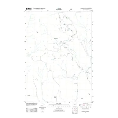
2012 Map of Ramshorn Peak
USGS Topo · Published 2012About this map
Ramshorn Peak and the surrounding high-altitude drainage basins of northwestern Fremont County characterize this portion of the Absaroka Range during the early twenty-first century. The landscape is defined by its complex hydrology, where Burroughs Cr and Horse Cr carve through high meadows like Deacon Meadows and Ramshorn Basin. Human activity is primarily centered on remote outposts and historical operations, including the T Cross Ranch and the Fisher Tie Camp, the latter reflecting the area's history of timber harvesting for the railroad industry. Local ranching footprints are evident through established holdings such as the Utzinger Ranch, Adams Ranch, and Houg Ranch. Higher elevations are marked by alpine water bodies like Burnt Timber Lake, Virgin Lake, and Rainbow Lake, while the southern terrain rises toward Battrum Mountain and E A Mountain.
Find a feature on this map
32 named features on this map. Tap any name to fly to it.
Don’t see what you’re looking for? This feature index may not catch every label — zoom into the map to look around manually.
Map Details
Editions of this 2012 Ramshorn Peak Map
This is the sole edition of this map. No revisions or reprints were ever made.
Other maps of this area

1905 · Younts Peak
USGS Topo · 1:125,000

1907 · Younts Peak
USGS Topo · 1:125,000

1955 · Thermopolis
USGS Topo · 1:250,000

1956 · Indian Point
USGS Topo · 1:24,000

1956 · Dubois
USGS Topo · 1:24,000

1956 · Esmond Park
USGS Topo · 1:24,000

1956 · Shoshone Pass
USGS Topo · 1:24,000

1956 · Ramshorn Peak
USGS Topo · 1:24,000

1956 · Snow Lake
USGS Topo · 1:24,000

1956 · Warm Spring Mountain
USGS Topo · 1:24,000