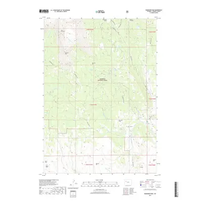
2017 Map of Ramshorn Peak
USGS Topo · Published 2017About this map
Ramshorn Peak and the high ridges of the Absaroka Range dominate this portion of the Shoshone National Forest in Wyoming. This landscape is defined by its dramatic vertical relief, where steep drainage systems like Wagon Gulch and Fivemile Cr drop away from the prominent summits of Battrum Mtn and E A Mtn. The survey details an intricate network of backcountry access points, including the Ramshorn Trail and the Horse Creek Cutoff Trail, which connect high-altitude water bodies such as Ramshorn Lakes and Virgin Lake. The presence of Amoretti Park and Deacon Meadows suggest pockets of more level terrain amidst the peaks, while the naming of Burnt Timber Lake points toward the environmental history of the forest's timber resources and fire cycles.
Find a feature on this map
39 named features on this map. Tap any name to fly to it.
Don’t see what you’re looking for? This feature index may not catch every label — zoom into the map to look around manually.
Map Details
Editions of this 2017 Ramshorn Peak Map
This is the sole edition of this map. No revisions or reprints were ever made.
Other maps of this area

1905 · Younts Peak
USGS Topo · 1:125,000

1907 · Younts Peak
USGS Topo · 1:125,000

1955 · Thermopolis
USGS Topo · 1:250,000

1956 · Indian Point
USGS Topo · 1:24,000

1956 · Dubois
USGS Topo · 1:24,000

1956 · Esmond Park
USGS Topo · 1:24,000

1956 · Shoshone Pass
USGS Topo · 1:24,000

1956 · Ramshorn Peak
USGS Topo · 1:24,000

1956 · Snow Lake
USGS Topo · 1:24,000

1956 · Warm Spring Mountain
USGS Topo · 1:24,000