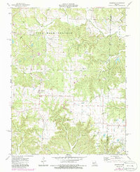
1973 Map of Readsville
USGS Topo · Published 1986About this map
The Nine Mile Prairie and Aux Vasse regions define this agricultural landscape in eastern Missouri, as documented in the early 1970s. The settlement of Readsville serves as a local hub, while smaller clusters like Yucatan dot the uplands. This area is heavily marked by rural religious and burial sites, including Antioch Ch and Mt Horeb Ch, alongside numerous family and church graveyards such as Gregory Cem, Whitehead Cem, and St Patricks Cem. The drainage pattern is led by the Prairie Fork and the Loutre River, which carve through the terrain. Evidence of local industry is visible in the scattered Claypits and a Quarry near the Callaway and Montgomery county line, indicating a reliance on natural resources and clay extraction during this period.
Find a feature on this map
31 named features on this map. Tap any name to fly to it.
Don’t see what you’re looking for? This feature index may not catch every label — zoom into the map to look around manually.
Map Details
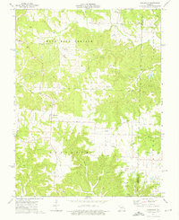
Editions of this 1973 Readsville Map
2 editions found
Other maps of this area

1890 · Fulton
USGS Topo · 1:125,000

1928 · Fulton
USGS Topo · 1:62,500

1931 · Fulton
USGS Topo · 1:62,500

1935 · Morrison
USGS Topo · 1:48,000

1940 · Montgomery City
USGS Topo · 1:62,500

1942 · Montgomery City
USGS Topo · 1:62,500

1942 · Morrison
USGS Topo · 1:62,500

1945 · Mokane
USGS Topo · 1:62,500

1945 · Morrison
USGS Topo · 1:62,500

1949 · Saint Louis
USGS Topo · 1:250,000