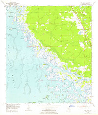
1954 Map of Red Level
USGS Topo · Published 1964About this map
The coastal wetlands and labyrinthine waterways of Citrus County dominate this 1954 survey, centered on the unincorporated settlement of Red Level. Along the eastern edge, human activity is concentrated near the intersection of Routes 19 and 98, where the Red Level Cem, Mt Olive Ch, and several Mines are located. The landscape quickly transitions westward into a complex system of marshes and islands, including Burtine Island and Everett Island, before reaching the Gulf of Mexico.
Find a feature on this map
62 named features on this map. Tap any name to fly to it.
Don’t see what you’re looking for? This feature index may not catch every label — zoom into the map to look around manually.
Map Details
Editions of this 1954 Red Level Map
5 editions found
Other maps of this area

1954 · Homosassa
USGS Topo · 1:24,000

1954 · Crystal River
USGS Topo · 1:24,000

1954 · Red Level
USGS Topo · 1:24,000

1954 · Yankeetown SE
USGS Topo · 1:24,000

1954 · Ozello
USGS Topo · 1:24,000

1954 · Gainesville
USGS Topo · 1:250,000

1955 · Withlacoochee Bay
USGS Topo · 1:24,000

1955 · Yankeetown
USGS Topo · 1:24,000

1955 · Plant City
USGS Topo · 1:250,000

1958 · Plant City
USGS Topo · 1:250,000