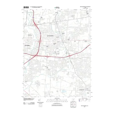
2010 Map of Reynoldsburg
USGS Topo · Published 2010About this map
Reynoldsburg and the eastern periphery of Columbus appear here during a period of significant suburban expansion at the start of the 21st century. The map documents a complex landscape of residential developments such as Rose Hill Heights and Idlewood Manor woven around established corridors like Winchester Pike and Reynoldsburg's own Main Street. The industrial and corporate presence in the region is notable, anchored by the Lucent Technologies facility and the Airport Commerce Park near Whitehall.
Find a feature on this map
74 named features on this map. Tap any name to fly to it.
Don’t see what you’re looking for? This feature index may not catch every label — zoom into the map to look around manually.
Map Details
Editions of this 2010 Reynoldsburg Map
This is the sole edition of this map. No revisions or reprints were ever made.
Other maps of this area

1902 · Westerville
USGS Topo · 1:62,500

1904 · Westerville
USGS Topo · 1:62,500

1907 · Thurston
USGS Topo · 1:62,500

1908 · Granville
USGS Topo · 1:62,500

1909 · Thurston
USGS Topo · 1:62,500

1910 · Granville
USGS Topo · 1:62,500

1925 · East Columbus
USGS Topo · 1:62,500

1943 · East Columbus
USGS Topo · 1:62,500

1947 · Columbus
USGS Topo · 1:250,000

1950 · Marion
USGS Topo · 1:250,000