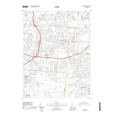
2019 Map of Reynoldsburg
USGS Topo · Published 2019About this map
Blacklick Estates and the expanding suburbs east of Columbus define this late 2010s landscape where Franklin, Fairfield, and Licking counties meet. The transition from the urban density of Whitehall and Reynoldsburg to the more open residential patterns of Pickerington and Pataskala is clearly visible. Historically significant sites are preserved amidst modern developments, including numerous burial grounds like the Silent Home Cem and the Asbury Methodist Episcopal Cem. The drainage patterns of Blacklick Creek and Big Walnut Creek weave through the suburban grid, while large-scale infrastructure such as the John Glenn Columbus International Airport dominates the northwestern corner. Educational and civic institutions, ranging from the World Harvest Bible College to the National K-9 School for Dog Trainers, reflect the diverse community growth along the East Broad Street and East Main Street corridors.
Find a feature on this map
58 named features on this map. Tap any name to fly to it.
Don’t see what you’re looking for? This feature index may not catch every label — zoom into the map to look around manually.
Map Details
Editions of this 2019 Reynoldsburg Map
This is the sole edition of this map. No revisions or reprints were ever made.
Other maps of this area

1902 · Westerville
USGS Topo · 1:62,500

1904 · Westerville
USGS Topo · 1:62,500

1907 · Thurston
USGS Topo · 1:62,500

1908 · Granville
USGS Topo · 1:62,500

1909 · Thurston
USGS Topo · 1:62,500

1910 · Granville
USGS Topo · 1:62,500

1925 · East Columbus
USGS Topo · 1:62,500

1943 · East Columbus
USGS Topo · 1:62,500

1947 · Columbus
USGS Topo · 1:250,000

1950 · Marion
USGS Topo · 1:250,000