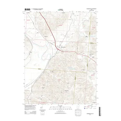
2013 Map of Richmond Dale
USGS Topo · Published 2013About this map
Richmond Dale serves as a primary hub for this portion of Ross County, situated where the Scioto River valley meets the rugged creek-fed hills to the east. The landscape is defined by the winding course of Salt Creek, which flows past the settlement at West Junction and joins the larger river system. Numerous family-named landmarks and cemeteries are scattered throughout the hills, including Beals Cem and the Little Mound Cem near the town center, suggesting a long history of local settlement and genealogical depth. Higher elevations are marked by distinctive geological features like Chimney Rocks and Buzzard Rock. The area's water management is evident in the industrial footprints of Southern Silica Pond Number One and Southern Silica Pond Number Two, while smaller communities like Vigo and the colorful Lickskillet populate the northern reaches of the quadrangle along the railroad corridors.
Find a feature on this map
84 named features on this map. Tap any name to fly to it.
Don’t see what you’re looking for? This feature index may not catch every label — zoom into the map to look around manually.
Map Details
Editions of this 2013 Richmond Dale Map
This is the sole edition of this map. No revisions or reprints were ever made.
Other maps of this area

1906 · Waverly
USGS Topo · 1:62,500

1906 · Chillicothe
USGS Topo · 1:62,500

1908 · Chillicothe
USGS Topo · 1:62,500

1908 · Waverly
USGS Topo · 1:62,500

1910 · Laurelville
USGS Topo · 1:62,500

1912 · Laurelville
USGS Topo · 1:62,500

1913 · Jackson
USGS Topo · 1:62,500

1944 · Jackson
USGS Topo · 1:62,500

1944 · Laurelville
USGS Topo · 1:62,500

1947 · Columbus
USGS Topo · 1:250,000