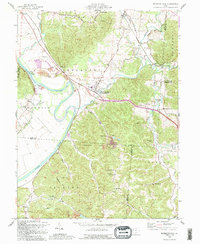
1992 Map of Richmond Dale
USGS Topo · Published 1995About this map
Salt Creek winds through the hills of Ross County, defining the valley where the B & O RR and Chesapeake and Ohio RR converge at West Junction. The landscape is a mix of heavy timber within the Scioto Trail State Forest and the broad alluvial plains of the Scioto River. A significant vestige of 19th-century infrastructure remains visible in the Ohio and Erie Canal (Abandoned), which parallels the river past Higby. Genealogists will find numerous family and community burial grounds, such as Caldwell Cem and Tweed Cem, alongside landmarks like the Pleasant Valley Ch. To the south, the terrain rises toward Chimney Rocks and Buzzard Rock, while small settlements like Richmond Dale and Limerick occupy the lower draws and crossroads.
Find a feature on this map
60 named features on this map. Tap any name to fly to it.
Don’t see what you’re looking for? This feature index may not catch every label — zoom into the map to look around manually.
Map Details
Editions of this 1992 Richmond Dale Map
This is the sole edition of this map. No revisions or reprints were ever made.
Other maps of this area

1906 · Waverly
USGS Topo · 1:62,500

1906 · Chillicothe
USGS Topo · 1:62,500

1908 · Chillicothe
USGS Topo · 1:62,500

1908 · Waverly
USGS Topo · 1:62,500

1910 · Laurelville
USGS Topo · 1:62,500

1912 · Laurelville
USGS Topo · 1:62,500

1913 · Jackson
USGS Topo · 1:62,500

1944 · Jackson
USGS Topo · 1:62,500

1944 · Laurelville
USGS Topo · 1:62,500

1947 · Columbus
USGS Topo · 1:250,000