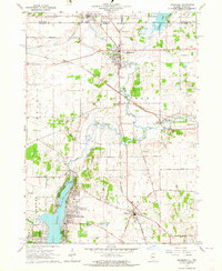
1963 Map of Richmond
USGS Topo · Published 1964About this map
Wonder Lake and its surrounding residential developments define the southern landscape of this 1963 survey, where the Nippersink Creek is managed by a Spillway at the lake's northern edge. The map captures the borderlands of Illinois and Wisconsin, anchored by the village of Richmond and the southern edge of Genoa City. This era shows a region defined by transit and small-town industry, with the Chicago and North Western and Chicago Milwaukee St Paul and Pacific railroads intersecting the terrain. Local history is preserved through numerous family and community landmarks, including the Carr-Harrison Cem and Harrison Sch. North of Ringwood, the landscape transitions from the developed shores of the lake into an agricultural and riparian network marked by the North Branch Nippersink Creek and the marshy expanses of Elizabeth Lake near the state line.
Find a feature on this map
44 named features on this map. Tap any name to fly to it.
Don’t see what you’re looking for? This feature index may not catch every label — zoom into the map to look around manually.
Map Details
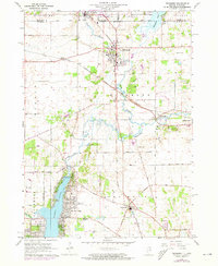
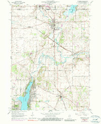
Editions of this 1963 Richmond Map
3 editions found
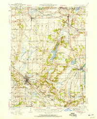
Other maps of this area

1893 · Silver Lake
USGS Topo · 1:62,500

1893 · Geneva
USGS Topo · 1:62,500

1904 · Lake Geneva
USGS Topo · 1:62,500

1906 · Silver Lake
USGS Topo · 1:62,500

1906 · Lake Geneva
USGS Topo · 1:62,500

1920 · Grays Lake
USGS Topo · 1:62,500

1923 · Grays Lake
USGS Topo · 1:62,500

1926 · Mc Henry
USGS Topo · 1:62,500
1944 · McHenry
USGS Topo · 1:62,500

1954 · Rockford
USGS Topo · 1:250,000