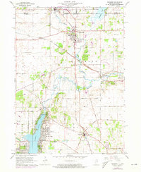
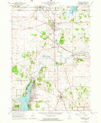
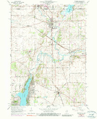
1963 Map of Richmond
USGS Topo · Published 1973About this map
Wonder Lake and its surrounding residential tracts anchor the southern portion of this landscape, while the state boundary between Wisconsin and Illinois bisects the northern reaches. The settlement of Richmond serves as a central hub where the Chicago and North Western railway intersects with local routes like Harts Road. This era reveals a transition from traditional rural agriculture toward recreation and suburban growth, evidenced by the development around the reservoir and the presence of Gait Airport.
Find a feature on this map
43 named features on this map. Tap any name to fly to it.
Don’t see what you’re looking for? This feature index may not catch every label — zoom into the map to look around manually.
Map Details
Editions of this 1963 Richmond Map
3 editions found
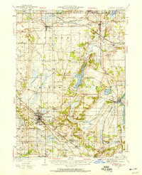
Other maps of this area

1893 · Silver Lake
USGS Topo · 1:62,500

1893 · Geneva
USGS Topo · 1:62,500

1904 · Lake Geneva
USGS Topo · 1:62,500

1906 · Silver Lake
USGS Topo · 1:62,500

1906 · Lake Geneva
USGS Topo · 1:62,500

1920 · Grays Lake
USGS Topo · 1:62,500

1923 · Grays Lake
USGS Topo · 1:62,500

1926 · Mc Henry
USGS Topo · 1:62,500
1944 · McHenry
USGS Topo · 1:62,500

1954 · Rockford
USGS Topo · 1:250,000