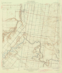
1932 Map of Rio Hondo
USGS Topo · Published 1932About this map
Arroyo Colorado and the winding Resaca De Los Fresnos dominate this Lower Rio Grande Valley landscape during a period of significant agricultural and railroad expansion. The map illustrates a transition from traditional ranching, evidenced by the Las Yescas Ranch, to a structured grid of irrigation canals and roads supporting new rail-side settlements like Lantana and Lozano. The Missouri Pacific and Southern Pacific lines cross-hatch the territory, facilitating the growth of Rio Hondo and the outskirts of San Benito. Local social hubs are clearly marked, including the Mexican Christian Ch and rural education centers such as Las Yescas Sch and San Jose Ranch Sch. This 1929 survey highlights the intricate hydrology of the region, where the natural meanders of the resacas were being integrated into the developing water management systems of Cameron County.
Find a feature on this map
27 named features on this map. Tap any name to fly to it.
Don’t see what you’re looking for? This feature index may not catch every label — zoom into the map to look around manually.
Map Details
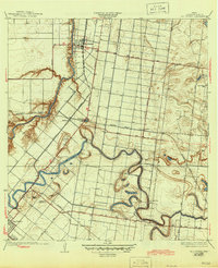
Editions of this 1932 Rio Hondo Map
3 editions found
Other maps of this area

1929 · Rio Hondo
USGS Topo · 1:24,000

1929 · Harlingen
USGS Topo · 1:24,000

1929 · La Paloma
USGS Topo · 1:24,000

1930 · Los Fresnos
USGS Topo · 1:24,000

1930 · Barreda
USGS Topo · 1:24,000

1930 · La Leona
USGS Topo · 1:24,000

1930 · Laguna Atascosa
USGS Topo · 1:24,000

1932 · Combes
USGS Topo · 1:31,680

1932 · Rio Hondo
USGS Topo · 1:31,680

1932 · Harlingen
USGS Topo · 1:31,680