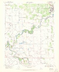
1969 Map of Ripon
USGS Topo · Published 1971About this map
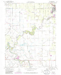
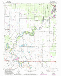
The Stanislaus River meanders through this agricultural landscape, forming the natural boundary between San Joaquin and Stanislaus Counties. In the late 1960s, the town of Ripon sits at the northeastern corner of the map, established along the Southern Pacific railroad line. The surrounding countryside is defined by its water management and diverse hydrology, including the Hetch Hetchy Aqueduct, which cuts across the southern portion of the sheet. Significant natural and man-made features like Miller Lake, Riley Slough, and Finnegan Cut reveal the complex riparian environment of the San Joaquin Valley floor. Established family holdings like Mapes Ranch and the Mc Mullin Ranch are situated near the banks of the San Joaquin River, while the Caswell Memorial State Park preserves a rare stand of oak woodland along a dramatic bend in the Stanislaus.
Find a feature on this map
38 named features on this map. Tap any name to fly to it.
Don’t see what you’re looking for? This feature index may not catch every label — zoom into the map to look around manually.
Map Details
Editions of this 1969 Ripon Map
6 editions found
Other maps of this area

1913 · Romain
USGS Topo · 1:31,680

1914 · Manteca
USGS Topo · 1:31,680

1914 · Avena
USGS Topo · 1:31,680

1915 · Vernalis
USGS Topo · 1:31,680

1915 · Lathrop
USGS Topo · 1:31,680

1915 · Ripon
USGS Topo · 1:31,680

1915 · Westport
USGS Topo · 1:31,680

1915 · Westley
USGS Topo · 1:31,680

1915 · Salida
USGS Topo · 1:31,680

1916 · Romain
USGS Topo · 1:31,680