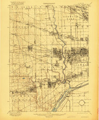
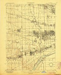
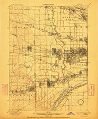
1901 Map of Riverside
USGS Topo · Published 1920About this map
The Des Plaines River and the North Branch Chicago River anchor this late 19th-century landscape as the Chicago metropolitan area expanded westward into Cook and DuPage counties. The map documents an era of intense civil engineering and transit development, most notably the Chicago Sanitary and Ship Canal and the massive industrial footprint of the Chicago Union Transfer Railroad Yards. Local commerce and community life are centered around the dense network of lines like the Chicago Milwaukee and St. Paul R.R. and the Chicago Great Western R.R., which connected early settlements such as Bensenville, Elmhurst, and Maywood to the city core.
Find a feature on this map
86 named features on this map. Tap any name to fly to it.
Don’t see what you’re looking for? This feature index may not catch every label — zoom into the map to look around manually.
Map Details
Editions of this 1901 Riverside Map
4 editions found

Historical Maps of Chicago Through Time
4 maps found


