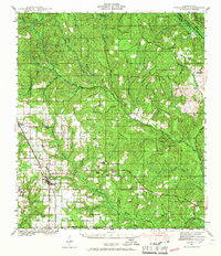
1941 Map of Robertsdale
USGS Topo · Published 1967About this map
Agricultural clearing meets dense riverine bottomlands in this 1940s-era survey of central Baldwin County. The Louisville and Nashville railroad corridor anchors the western settlements of Loxley, Robertsdale, and Silverhill, where a geometric grid of roads like Woodlawn Road and Gibson Road defines the growing farm country. To the east, the landscape shifts toward the winding drainage basins of the Styx River and Perdido River, which forms the boundary with Florida.
Find a feature on this map
54 named features on this map. Tap any name to fly to it.
Don’t see what you’re looking for? This feature index may not catch every label — zoom into the map to look around manually.
Map Details
Editions of this 1941 Robertsdale Map
3 editions found

Other maps of this area

1920 · Robertsdale
USGS Topo · 1:62,500

1921 · Bon Secour
USGS Topo · 1:62,500

1921 · Point Clear
USGS Topo · 1:62,500

1921 · Fairhope
USGS Topo · 1:62,500

1921 · Fort Barrancas
USGS Topo · 1:62,500

1921 · Muscogee
USGS Topo · 1:62,500

1940 · Silverhill
USGS Topo · 1:31,680

1941 · Fort Barrancas
USGS Topo · 1:62,500

1941 · Silverhill
USGS Topo · 1:31,680

1941 · Bay Minette
USGS Topo · 1:62,500