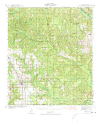
1941 Map of Robertsdale
USGS Topo · Published 1973About this map
Robertsdale and Silverhill anchor the agricultural and rail landscape of central Baldwin County during the early 1940s. The Louisville and Nashville railroad corridor serves as the primary artery for these growing communities, while the surrounding piney woods are dissected by an intricate drainage system including the Perdido River and Styx River. Cultural landmarks like Rainbow Ch, Bethel Chapel, and Blackwater Sch reveal the distributed nature of rural life before post-war consolidation. A notable inclusion is the CCC Camp near the Blackwater River, a physical remnant of Great Depression-era work programs. From the Old Mill Bridge in the north to the Greek Cem in the south, the map documents a transition from timber and creek-bottom lands to organized town plots and rural schools like Bellefontaine Sch.
Find a feature on this map
53 named features on this map. Tap any name to fly to it.
Don’t see what you’re looking for? This feature index may not catch every label — zoom into the map to look around manually.
Map Details
Editions of this 1941 Robertsdale Map
3 editions found

Other maps of this area

1920 · Robertsdale
USGS Topo · 1:62,500

1921 · Bon Secour
USGS Topo · 1:62,500

1921 · Point Clear
USGS Topo · 1:62,500

1921 · Fairhope
USGS Topo · 1:62,500

1921 · Fort Barrancas
USGS Topo · 1:62,500

1921 · Muscogee
USGS Topo · 1:62,500

1940 · Silverhill
USGS Topo · 1:31,680

1941 · Fort Barrancas
USGS Topo · 1:62,500

1941 · Silverhill
USGS Topo · 1:31,680

1941 · Bay Minette
USGS Topo · 1:62,500