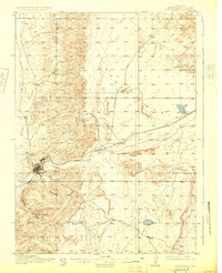
1910 Map of Rock Springs
USGS Topo · Published 1925About this map
Rock Springs serves as the focal point of this 1908 survey, situated at the junction of Killpecker Creek and Bitter Creek. The landscape is dominated by the strategic corridor of the Union Pacific railroad, which follows the drainage of Bitter Creek through a corridor flanked by the Eden Valley to the northwest and Browns Park to the south. This transport network facilitated the growth of several satellite settlements, including the rail stops at Baxter and Blairtown, and the community of Gunn to the north.
Find a feature on this map
14 named features on this map. Tap any name to fly to it.
Don’t see what you’re looking for? This feature index may not catch every label — zoom into the map to look around manually.
Map Details
Editions of this 1910 Rock Springs Map
3 editions found
Other maps of this area

1908 · Rock Springs
USGS Topo · 1:62,500

1910 · Rock Springs
USGS Topo · 1:62,500

1954 · Rock Springs
USGS Topo · 1:250,000

1957 · Firehole Basin
USGS Topo · 1:62,500

1958 · Rock Springs
USGS Topo · 1:250,000

1958 · Boars Tusk
USGS Topo · 1:62,500

1958 · Superior
USGS Topo · 1:62,500

1961 · Pilot Butte
USGS Topo · 1:24,000

1961 · Kanda
USGS Topo · 1:24,000

1962 · Rock Springs
USGS Topo · 1:250,000