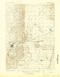
1910 Map of Rock Springs
USGS Topo · Published 1946About this map
Rock Springs serves as the industrial and transportation anchor for this high desert landscape, which was surveyed in 1908. The town sits at the confluence of Killpecker Creek and Bitter Creek, with the heavy infrastructure of the Union Pacific railroad corridor defining the valley's development. Small coal-mining communities and railroad stops like Gunn, Blairtown, and Baxter are clustered near the tracks, while the wider Eden Valley opens to the north. This map captures the region at a time when local transport relied on routes like Superior Road and Park Road, connecting isolated ranching and mining interests across Sweetwater County. For researchers, the presence of a Cem and water sources like Sixmile Spring provides critical detail for tracing early twentieth-century Wyoming frontier life and the expansion of the transcontinental rail network.
Find a feature on this map
13 named features on this map. Tap any name to fly to it.
Don’t see what you’re looking for? This feature index may not catch every label — zoom into the map to look around manually.
Map Details
Editions of this 1910 Rock Springs Map
3 editions found
Other maps of this area

1908 · Rock Springs
USGS Topo · 1:62,500

1910 · Rock Springs
USGS Topo · 1:62,500

1954 · Rock Springs
USGS Topo · 1:250,000

1957 · Firehole Basin
USGS Topo · 1:62,500

1958 · Rock Springs
USGS Topo · 1:250,000

1958 · Boars Tusk
USGS Topo · 1:62,500

1958 · Superior
USGS Topo · 1:62,500

1961 · Pilot Butte
USGS Topo · 1:24,000

1961 · Kanda
USGS Topo · 1:24,000

1962 · Rock Springs
USGS Topo · 1:250,000